

- This topic is empty.
-
AuthorPosts
-
2026-10-15 at 9:00 am #12360
A Mineral Exploration Geophysical Solution Built Around Signal Quality
For mining operators and geologists investigating deeper or more complex targets, the practical question is whether a survey can produce useful, interpretable evidence under site conditions. Equipment capability matters, but so do survey design, quality control, geological context, and follow-up verification.
Geomative positions its geophysical instruments and digital platforms around the proposition of “Making Subsurface Information Clearer and More Reliable.” This review considers how its published capabilities can support mineral exploration, while distinguishing equipment specifications from verified geological outcomes.
What a Mineral Exploration Geophysical Solution Must Actually Solve
Exploration teams can face several connected challenges:
-
Time-consuming field layouts and acquisition.
-
Difficult current injection or weak target responses.
-
Fragmented geological, geophysical, and engineering datasets.
-
Measurement problems discovered after the field crew has left.
These challenges require coordinated hardware, processing software, and project workflows. Higher transmitter capability may help in suitable electrical survey conditions, but it cannot replace appropriate survey geometry or sufficient contrast between the target and surrounding ground.
Likewise, integrating datasets can improve interpretation without eliminating the uncertainty inherent in geophysical measurements.
Who Is Behind the Solution
Geomative is headquartered in Shenzhen, China, and develops geophysical instruments and digital data platforms. Its current company profile describes it as a national high-tech enterprise, while its homepage reports customers served across more than 50 countries and regions.
Its published offering addresses mineral exploration, groundwater investigation, engineering geology, and environmental monitoring. These company credentials provide background; project suitability still needs to be evaluated against the proposed method, equipment configuration, and site conditions.
The Technical Foundation
Geomative’s offering connects electrical acquisition systems with digital processing and spatial visualization.
For the GD-20 specifically, the manufacturer lists optional transmission power up to 9000W, 24-bit A/D conversion, and power-line rejection of at least 120dB. These specifications should be assessed within the selected configuration and operating mode. They do not establish a universal detection depth or guarantee performance in every noise environment.
Geomative describes the GD-20 architecture as combining centralized control with distributed wiring. Its practical value depends on the survey layout, terrain, and acquisition requirements.
On the software side, DIGspace brings geophysical and geological datasets into a shared spatial environment. Its documented ERT functions include measurement review, contact-resistance checks, online inversion, and visualization. Three-dimensional presentation should be distinguished from the dimensionality and assumptions of the underlying inversion.
Before deployment, teams should test representative project data and confirm the required import, processing, and export functions.
The Product Matrix
The relevant offering can be considered in four functional groups.
Resistivity and IP Imaging Systems
The GD-10 is a single-channel electrical survey system. The GD-20 and GD-22 provide multi-channel options, with capabilities that depend on the model and configuration.
Selection should begin with the required measurements, survey geometry, acquisition workload, and target conditions. Maximum power, channel count, IP functions, and supported accessories should be checked separately rather than treated as identical across the range.
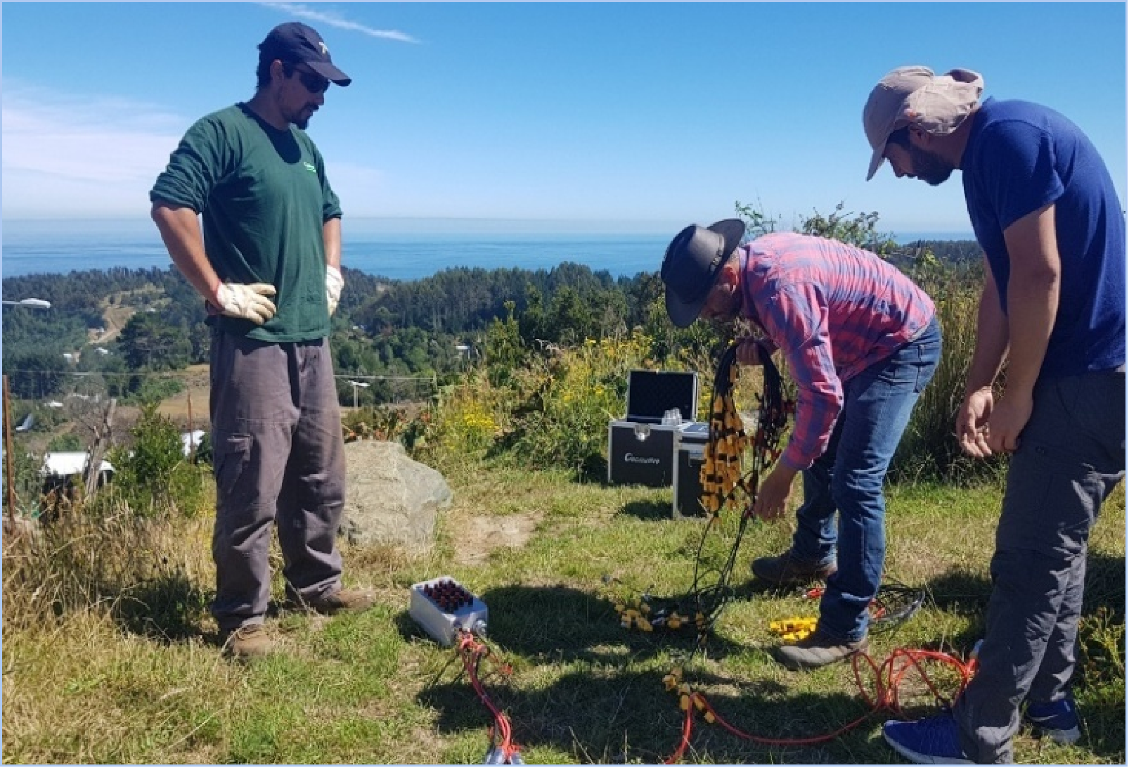
Ground, tunnel, borehole, and water-based surveys require suitable hardware arrangements and accessories. On-site data review can help identify measurement problems while corrective action remains practical.
Transient Electromagnetic Systems (TEM)
Geomative positions the GT-10 for medium and deep exploration, GT-20 for tunnel prediction, GT-30 for shallow investigations, and GT-40 for borehole TEM.
These applications should not be reduced to one depth range applying to every model. Effective investigation depth and resolution depend on the equipment setup, target properties, surrounding geology, and noise conditions.
For mineral projects, TEM results should be interpreted alongside geological information and other relevant evidence.
DIGspace Geospatial Platform
DIGspace supports the organization and spatial presentation of ERT, GPR, borehole records, and other project datasets. Its desktop and web capabilities support analysis and collaboration, while documented ERT workflows include online inversion.
A shared environment can help teams compare anomalies with geological observations and borehole information. Its usefulness depends on consistent coordinates, reliable source data, and traceable processing.
Required modules, deployment arrangements, and file exchanges should be confirmed for each project.
Survey Accessories
Geomative lists electrical survey cables for different deployment environments, SR-10 and SR-20 cable heads, and BP-600 and BP-1000 power supplies.
These components should be selected as part of a compatible electrical survey configuration. Connector arrangements, voltage and current ratings, environmental suitability, and instrument compatibility all matter. An accessory’s inclusion in the portfolio does not mean it supports every transmitter setting or is interchangeable with TEM equipment.
Documented Exploration and Survey Results
Published cases illustrate how the equipment has been applied and where verification remains necessary.
Brazil Gold Exploration. A published GD-10 resistivity and IP investigation delineated anomalies and recommended drilling to investigate possible sulfide-bearing zones. The case demonstrates support for target selection rather than confirmation of gold resources by geophysics alone.
Beishan Lead-Zinc Mine, China. Geomative reports using GT-30 TEM for underground water and mineral exploration. Interpretation combined measurements from multiple directions with known geological relationships. According to the company’s case report, subsequent exposure verified the interpreted locations of a water-bearing zone and a lead-zinc ore body.
Landfill Leakage Investigation. A published investigation combined spontaneous potential, the charging method, and ERT to assess suspected leakage pathways and low-resistivity zones. Three-dimensional presentation helped describe the interpreted anomaly distribution. Confirming contamination characteristics or liner damage requires appropriate sampling, inspection, or other independent evidence.
These cases support discussion of specific survey workflows. They do not establish identical outcomes at other sites.
Industry Coverage and Customer Fit
Geomative’s published applications extend across mineral exploration, hydrogeology, engineering investigations, and environmental monitoring. Equipment and workflow requirements vary with the decision each project needs to make.
Three customer groups may assess the offering differently:
-
Mining operators and geologists need measurements that help prioritize targets and investigate geological or groundwater conditions, supported by drilling and sampling where appropriate.
-
Environmental and civil engineers need survey coverage, resolution, and verification suited to foundation assessment, seepage investigation, and monitoring objectives.
-
Research institutions may require access to raw measurements, configurable acquisition, documented processing, and integration with other methods. These capabilities should be confirmed for the selected hardware and software.
Delivery and Deployment
The offering combines field instruments with desktop analysis and web collaboration. Building a coherent project workflow requires confirmation of instrument-to-platform compatibility, data transfer, processing functions, and access arrangements.
For teams evaluating a mineral exploration geophysical solution, the key question is how well the selected components support the entire investigation: acquisition, quality control, interpretation, and verification.
Geomative provides options across these stages. A practical evaluation should use the proposed configuration and representative data to establish whether the workflow meets the project’s requirements. The resulting geophysical interpretations should then be tested against geological observations, drilling, sampling, or other appropriate ground truth.
https://www.geomative.com
Geomative Co., Ltd. -
-
AuthorPosts

- You must be logged in to reply to this topic.